//project details
Architect: Suisman Urban Design
Project Location: Hartford, Connecticut
Photos: Suisman Urban Design
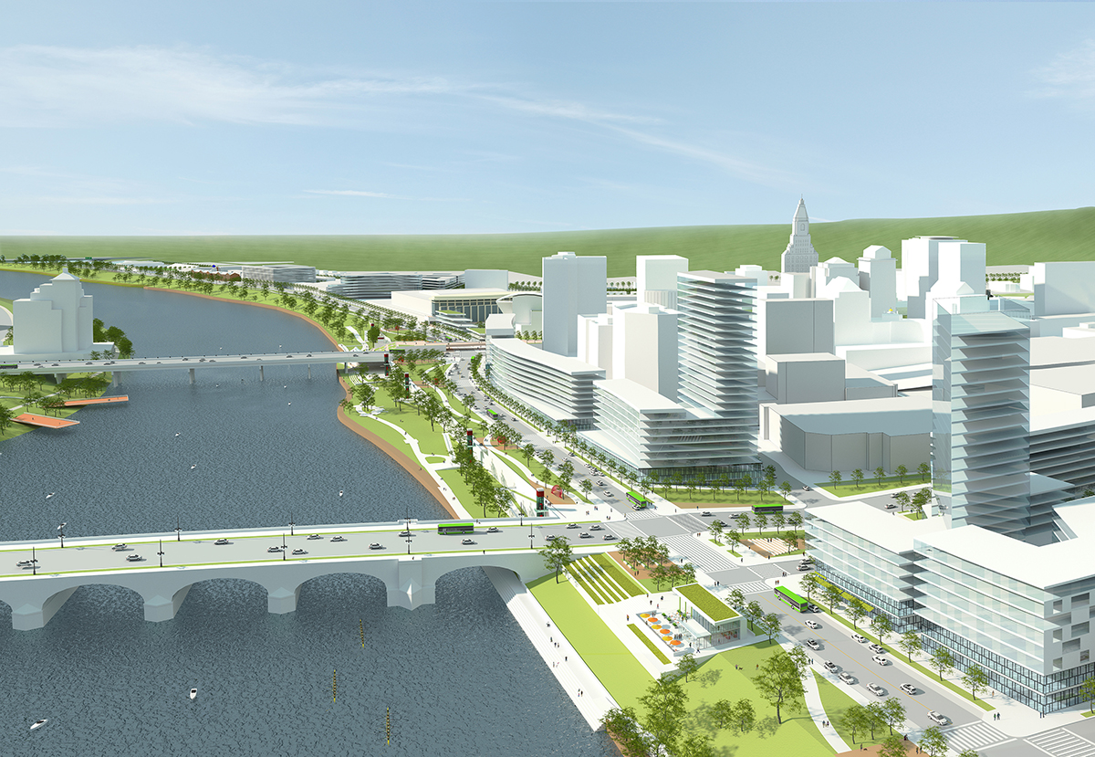
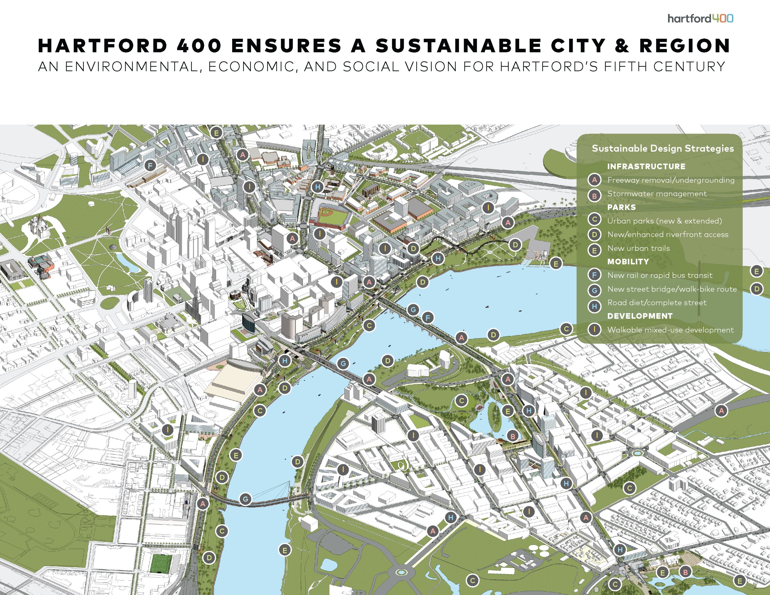
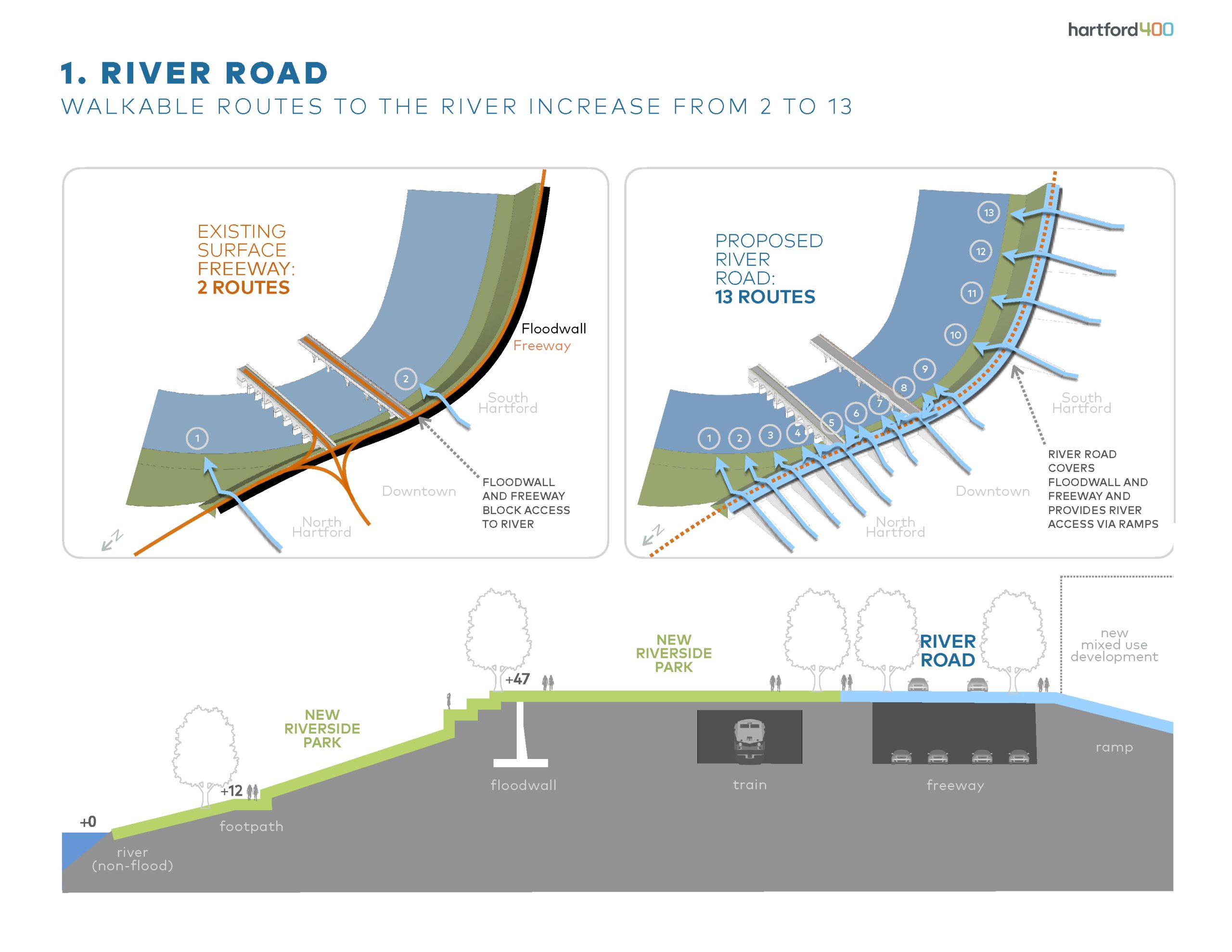
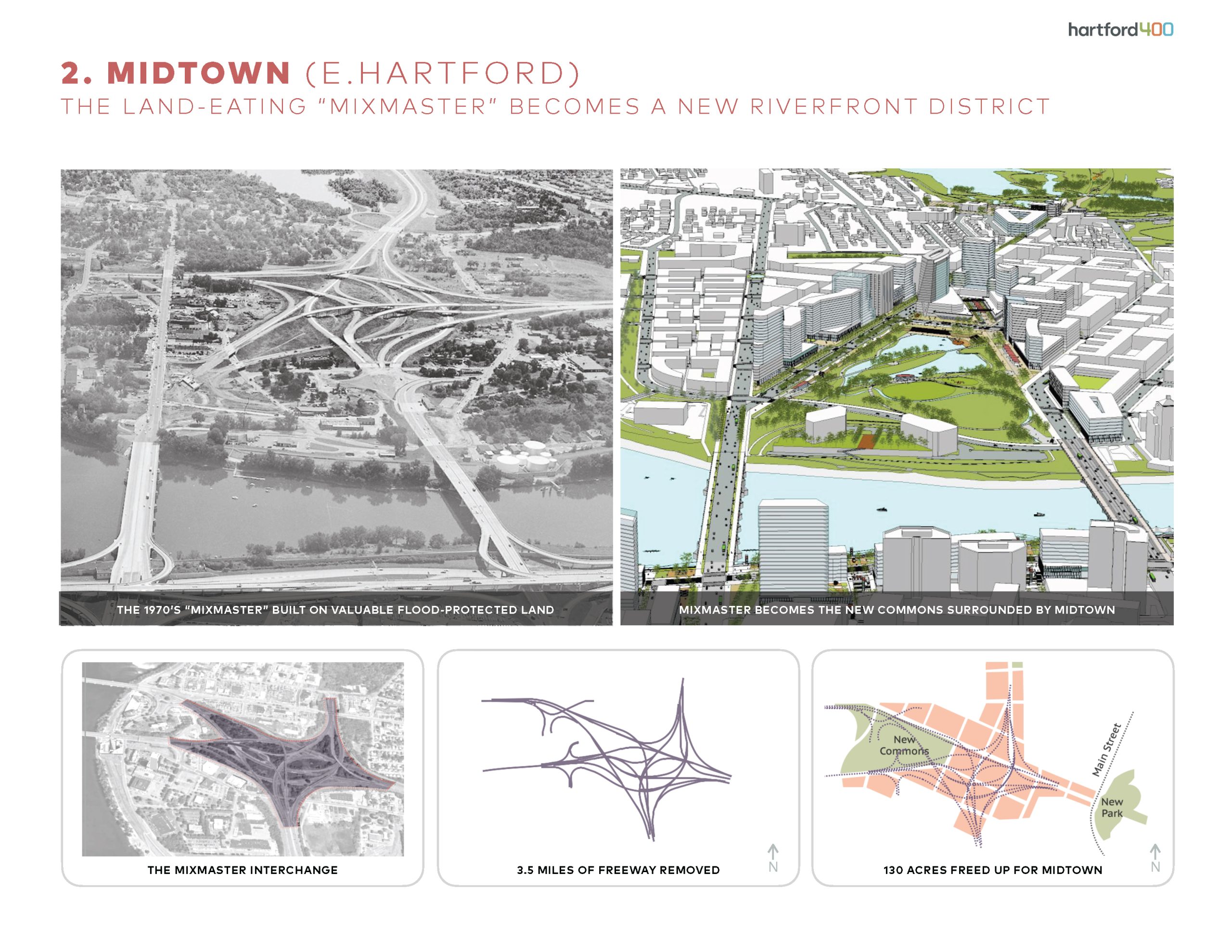
Hartford 400 is a river-centered vision plan for Connecticut’s capital region. The plan orchestrates three transformative urban infrastructure projects: “River Road” caps an obstructing freeway and floodwall to provide access to riverfront parkland; “Midtown” replaces a massive and wasteful highway interchange with a new walkable riverfront district; “The Hartline” converts a divisive rail and highway trench into a lateral urban greenway. Completion is timed for 2035, the 400th anniversary of the region’s urban settlement.
For 70 years, freeway and flood control infrastructure has blockaded Hartford from its river, and isolated the historically Black community of North Hartford, while working-class East Hartford has been overburdened with a gargantuan freeway interchange. The river bridges are all highways and discourage or prohibit biking and walking across. The new infrastructure bill has created a historic opportunity to restructure the freeway system to overcome these barriers.
Removing, relocating, tunneling, or capping major freeway segments will reunite both sides of the river, connect city neighborhoods with new and expanded riverfront parks, and remove historic discriminatory barriers that have hampered economic and social development. Two existing freeway bridges will be converted to street bridges, with the addition of a new third bridge to Coltsville National Historical Park , all designed to encourage transit, biking, and walking along and across the river.
Three transformative projects completed by 2035 for the region’s 400th anniversary: 1) River Road caps I-91 and the 47’ high floodwall to provide continuous waterfront access and add 1.5 miles of parkland; 2) Midtown replaces East Hartford’s “mixmaster” interchange with a new walkable riverfront district; 3) The Hartline replaces a divisive highway trench with an urban greenway for North Hartford, the central segment of a 14-mile bike-walk-transit trail connecting both sides of the river.