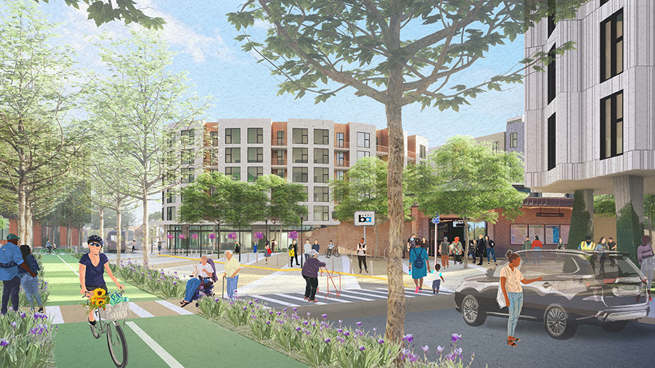
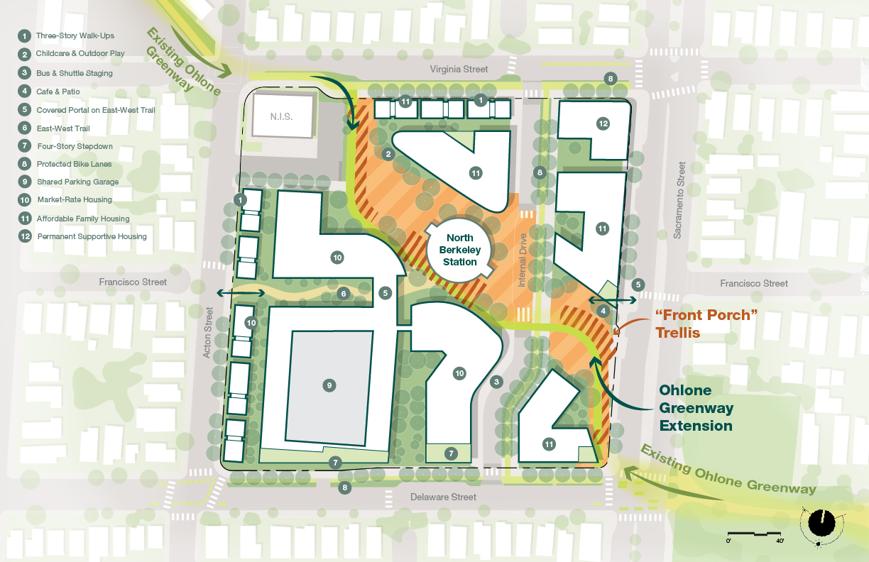
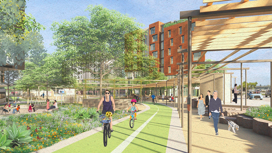
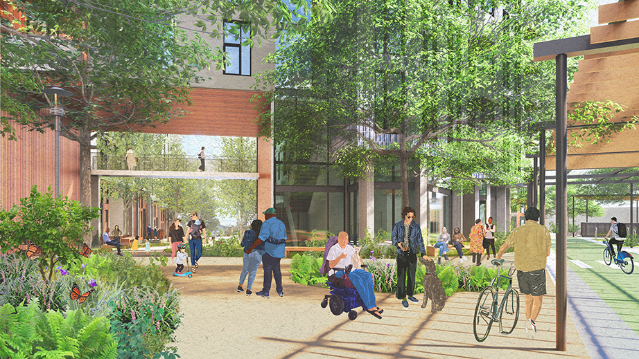
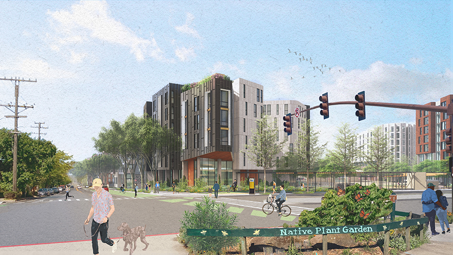
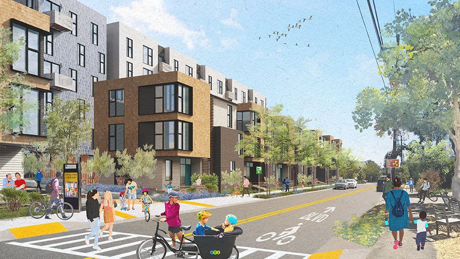
The North Berkeley BART Transit-Oriented Development Plan sensitively transforms eight acres of surface parking into a vibrant, mixed-use community with more than 700 diverse homes and extensive public open space on a prime transit site. This transit-rich, mixed-income plan reimagines four blocks to reconnect residents, the neighborhood, and the BART station. Developed with extensive community input, the plan establishes a unique urban identity rooted in local character and “distinctly Berkeley” influences—featuring quirky building shapes, natural materials, intimate public spaces, winding trails, native plantings, and community gathering areas. This place is both familiar and something new. The Plan includes 739 homes across 13 buildings centered on a park-style green space that reconnects the Ohlone Greenway (a 4.5-mile urban bike and pedestrian pathway) and adds over 50,000sf of public open space. A shared parking garage is located in the market-rate development. Half of the proposed homes are affordable, including permanent supportive homes for unhoused households. The design responds to the adjacent neighborhood character at each edge. New trails invite neighbors, new residents, and transit patrons. A welcoming civic-scale “front porch” offers seating and social spaces. Casual garden “rooms” integrate with ground-floor uses, including a childcare center, cafe, and a bicycle station. A new east-west trail extends Francisco Street and embraces a slower walking pace inspired by Berkeley’s hill stairs and trails. Extensive collaboration between the project team, BART, and the City of Berkeley enabled accelerated planning approvals under AB 2011, an unused pathway in Berkeley at the time.
The jury applauds the reuse of the transit structure. At the same time, the project creates a sense of place—a neighborhood which is engaged—through a wonderfully expressive design that reconciles the Transit Oriented program with the existing surroundings in a way that not only receives the BART users but also establishes a strong connective corridor to the neighborhoods and Ohlone Greenway. It demonstrates a robust community engagement process and use of an accelerated planning model that sounds novel and innovative.